
Image
Antigua Guatemala. Evangelical church, 2a Calle Oriente 14. Illustration, November 29, 1991.
Image
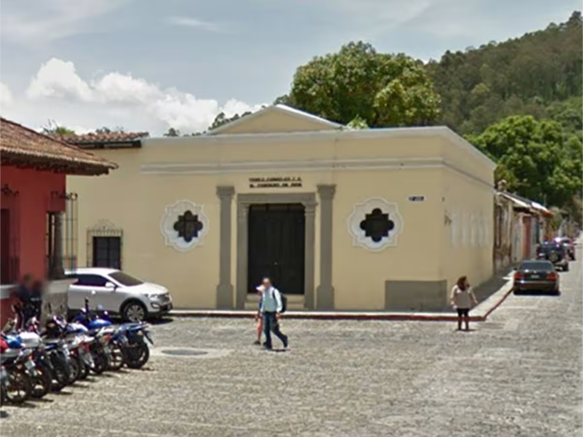
Antigua Guatemala. Evangelical church, 2a Calle Oriente 14.
Image
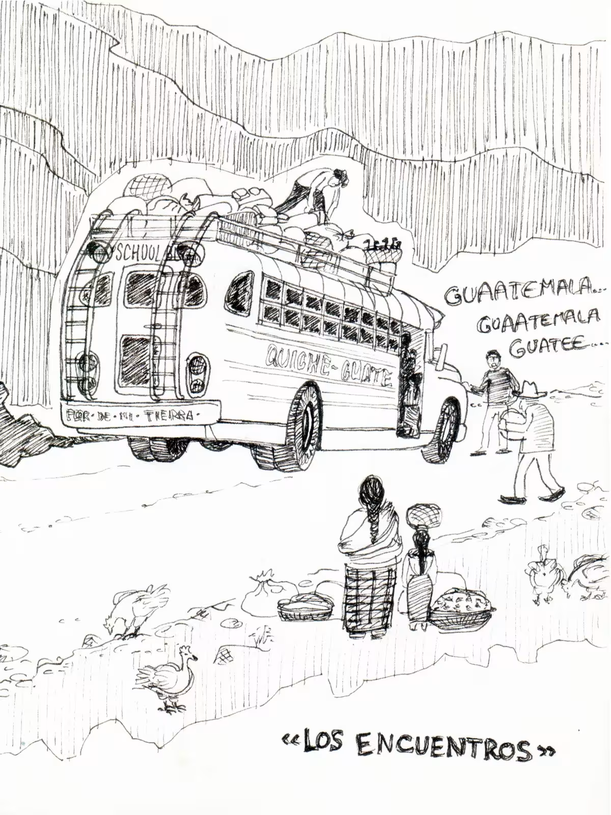
Los Encuentros, Guatemala. Ilustration.
Image
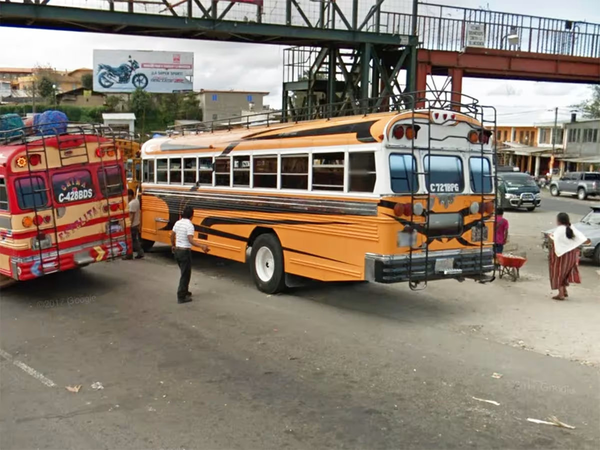
Los Encuentros, Guatemala. Photo : Google Earth.
Image
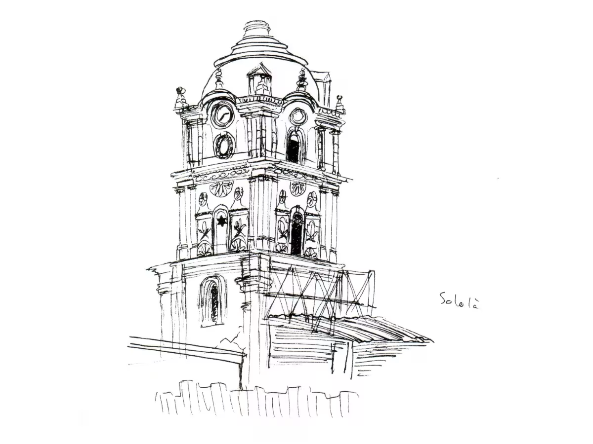
Sololá, Guatemala. Town hall bell tower. Illustration, December 10, 1991.
Image
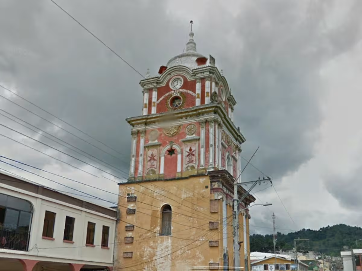
Sololá, Guatemala. Campanile de l’hôtel de ville. Photo : Google Earth.
Image
Sololá, Guatemala. Ordóñez Pharmacy. Illustration, December 10, 1991.
Image
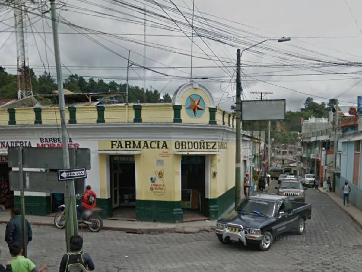
Sololá, Guatemala. Ordóñez Pharmacy. Photo: Google Earth.
Image
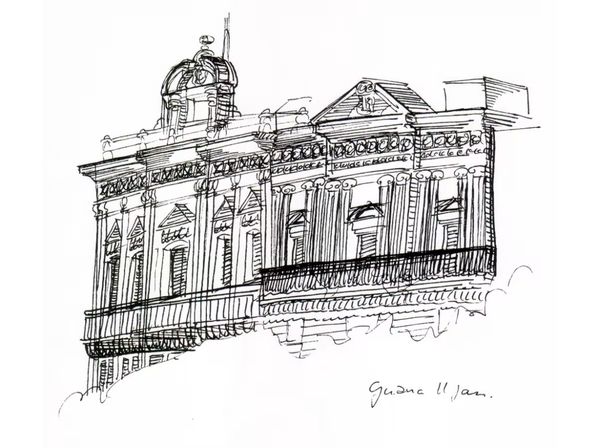
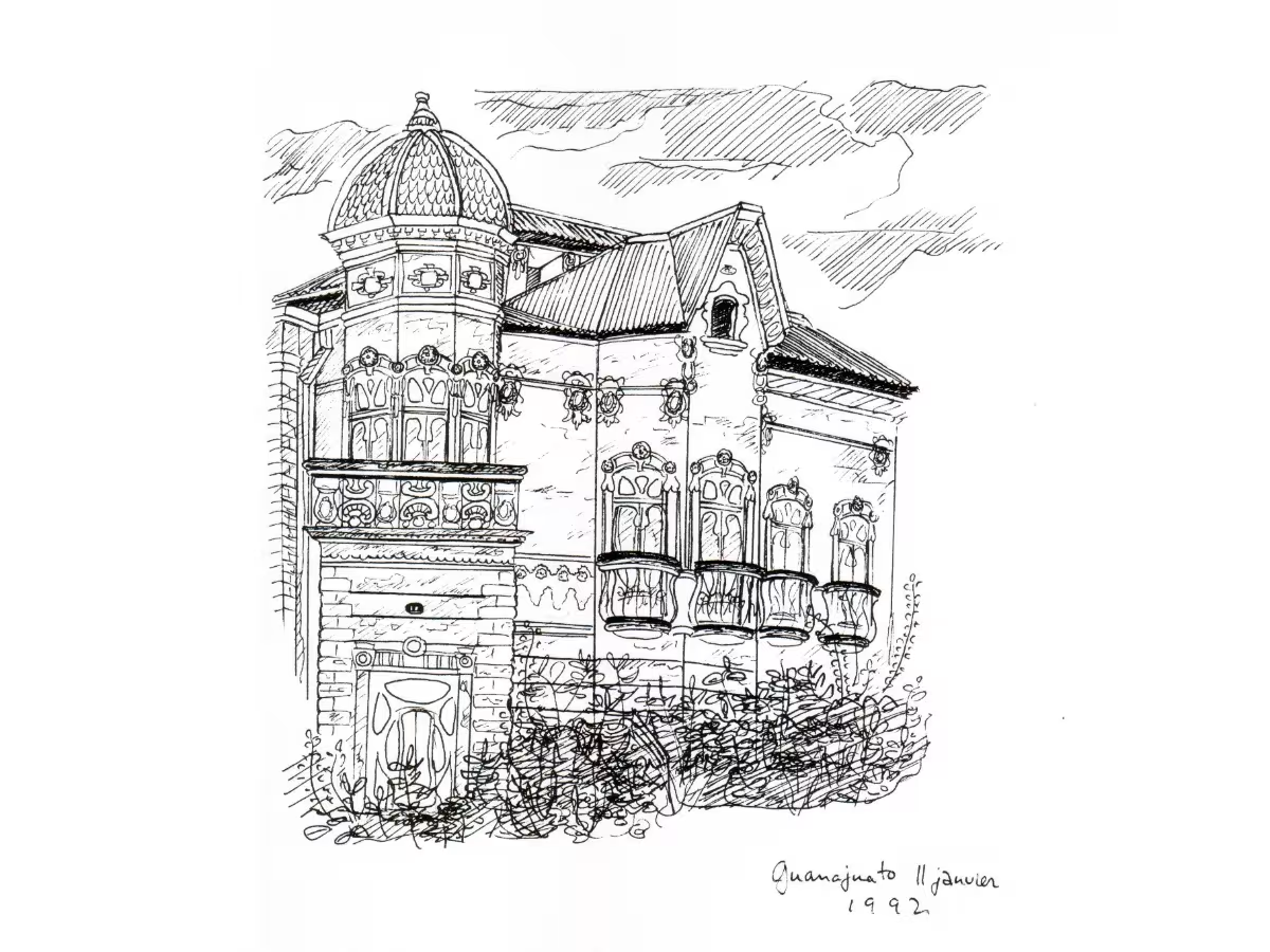
Guanajuato, Mexico. Plaza de la Paz. Illustration, January 11, 1992.
Image
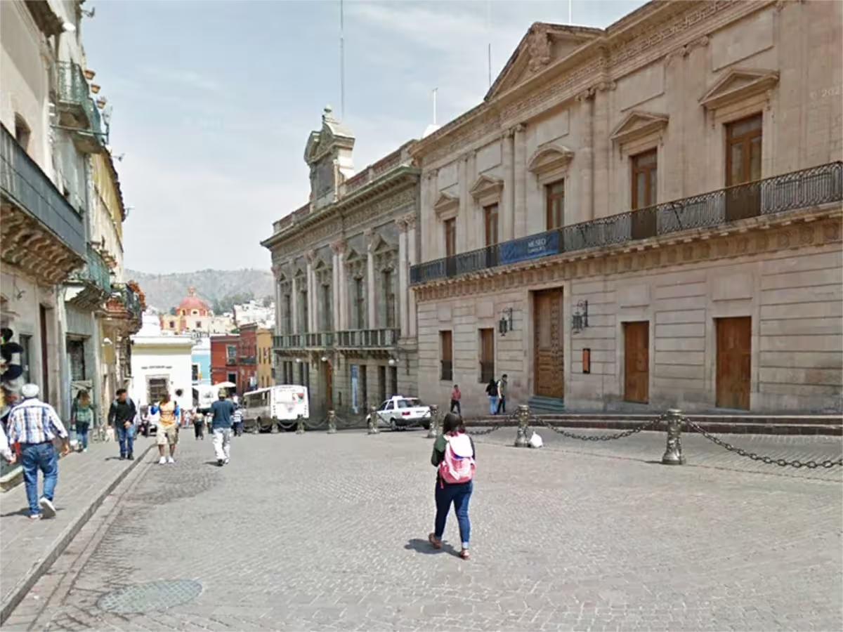
Guanajuato, Mexico. Plaza de la Paz with the Palacio de los Poderes Museum (center left) and the Conde Rul Museum (on the right). Photo: Google Earth.
Image
Guanajuato, Mexico. Casa de la Presa. Illustration, January 11, 1992.
Image
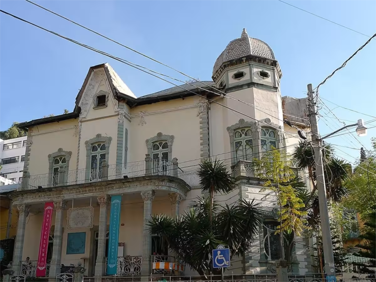
Guanajuato, Mexico. Casa de la Presa. Photo: Christian Schwarzer.
Image
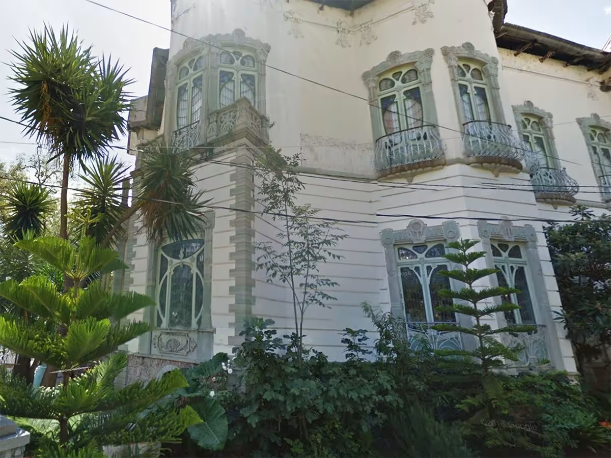
Guanajuato, Mexico. Casa de la Presa. Photo: Google Earth.
Image
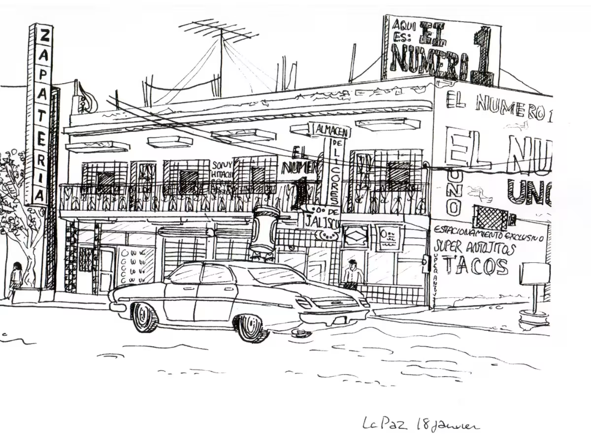
La Paz, Baja California Sur, Mexique. Édifice commercial. Illustration, 18 janvier 1992.
Image
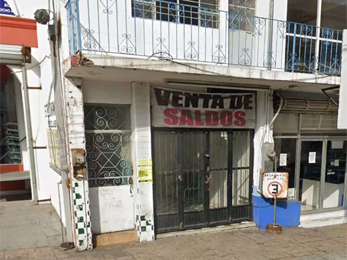
La Paz, Baja California Sur, Mexico. Commercial building. Photo: Google Earth.
Image
La Paz, Baja California Sur, Mexico. Commercial building. Close-up of the checkerboard pattern that made it possible to identify it.
Image
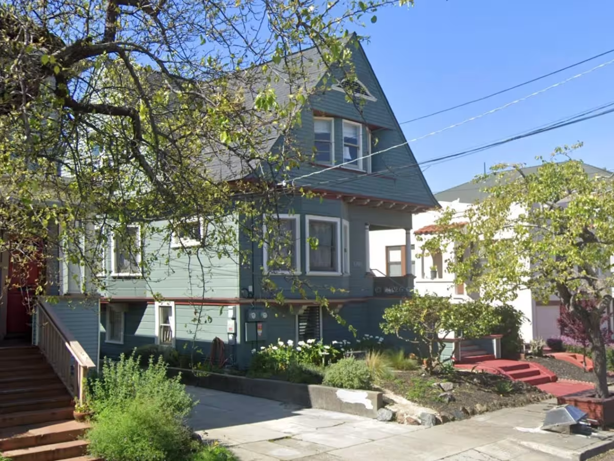
Oakland, California. 5709 Genoa St. Illustration, January 26, 1992.
Image
Oakland, California. 5709 Genoa St. Photo: Google Maps.
Image
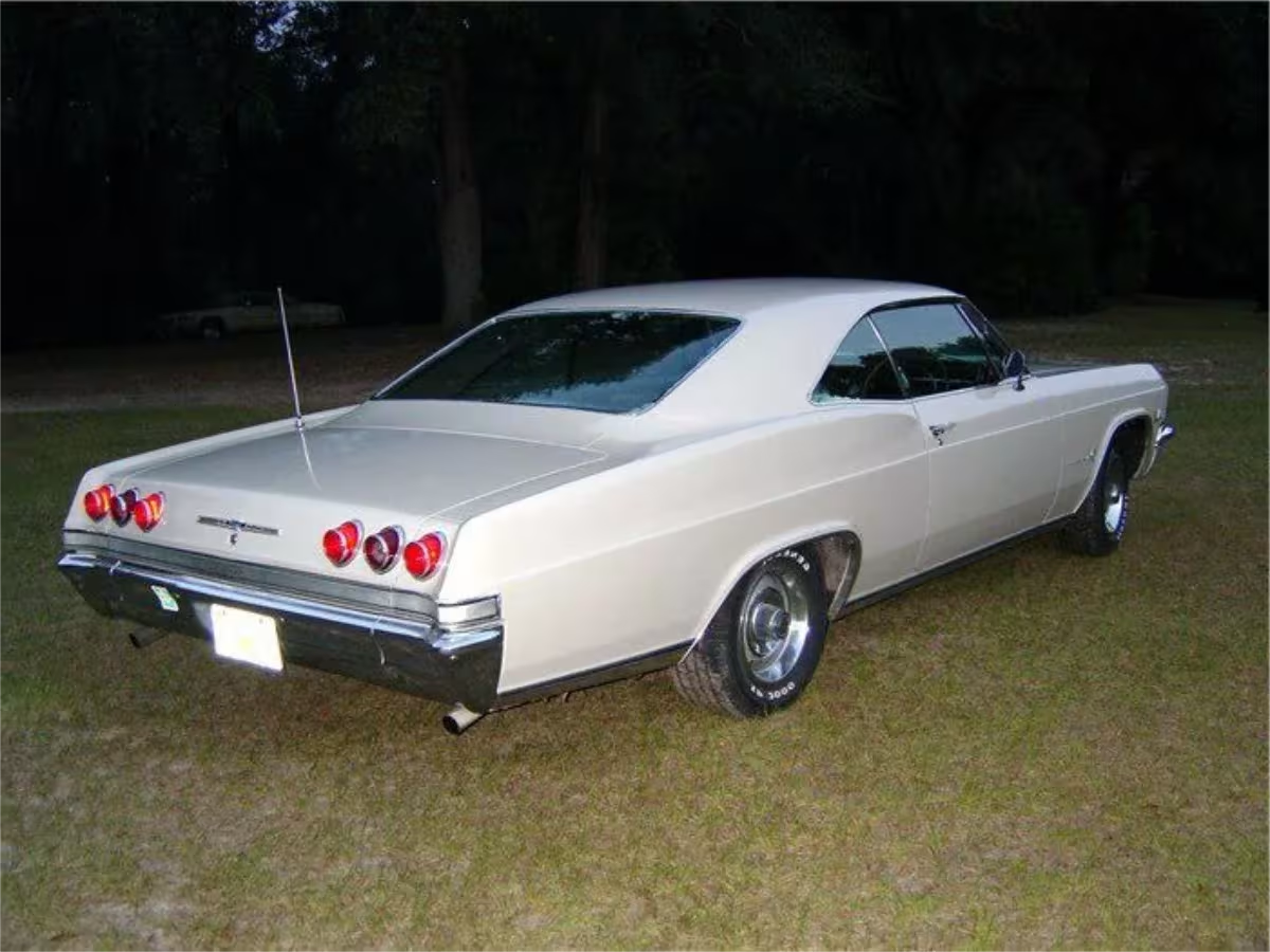
Oakland, California. 1965 Chevrolet Impala. Illustration.
Image
Oakland, California. 1965 Chevrolet Impala. Photo: Pinterest.
Image
San Francisco, California. Victorian house in the Haight-Ashbury neighborhood or a nearby area. Illustration, January 30, 1992.
Image
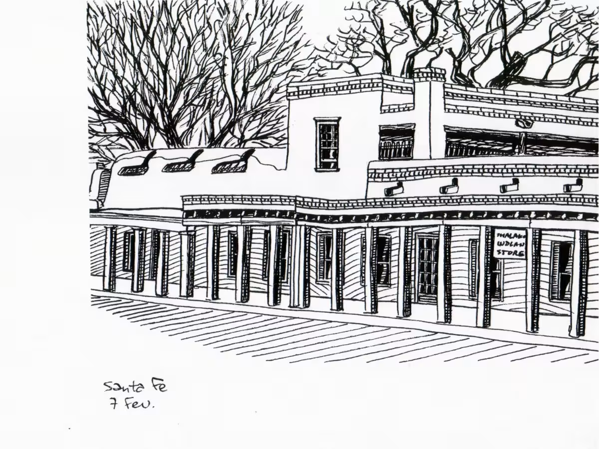
Santa Fe, New Mexico. Commercial building in the historic district. Illustration, February 7, 1992.
Image
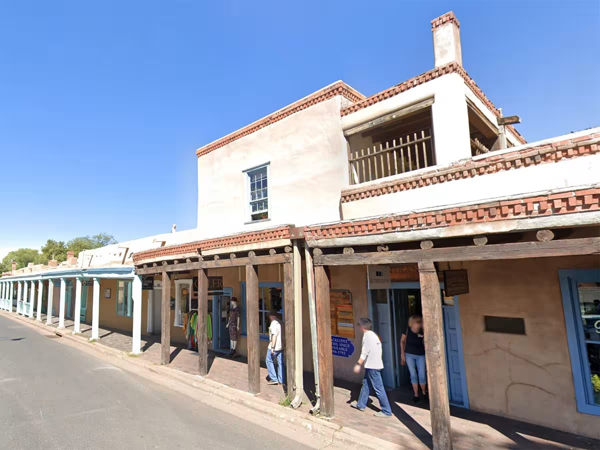
Santa Fe, New Mexico. Commercial building in the historic district. Photo: Google Earth.
Image
New Orleans. French-style wooden house on brick piers. Illustration, February 11, 1992.
Image
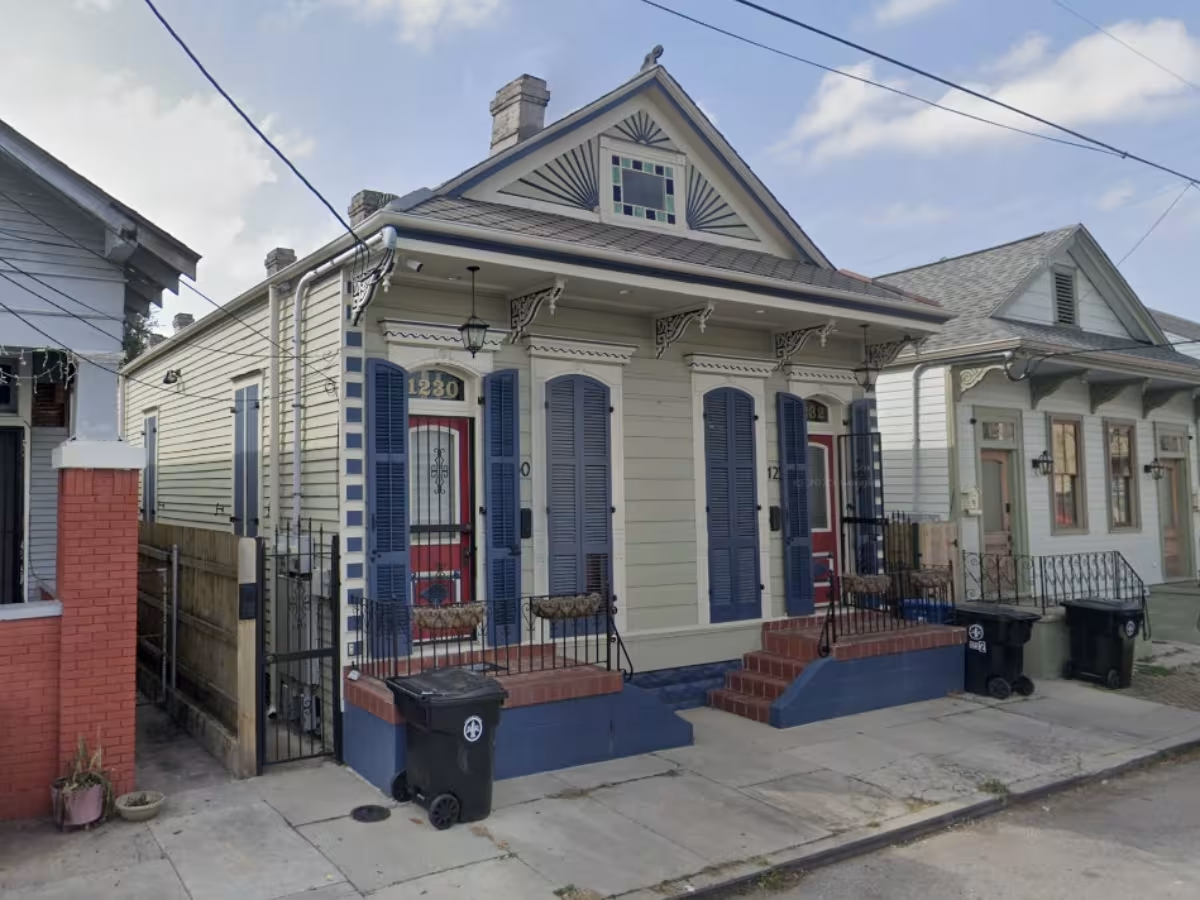
New Orleans, Louisiana. 1230 Frenchmen St. Photo: Google Maps.
Image
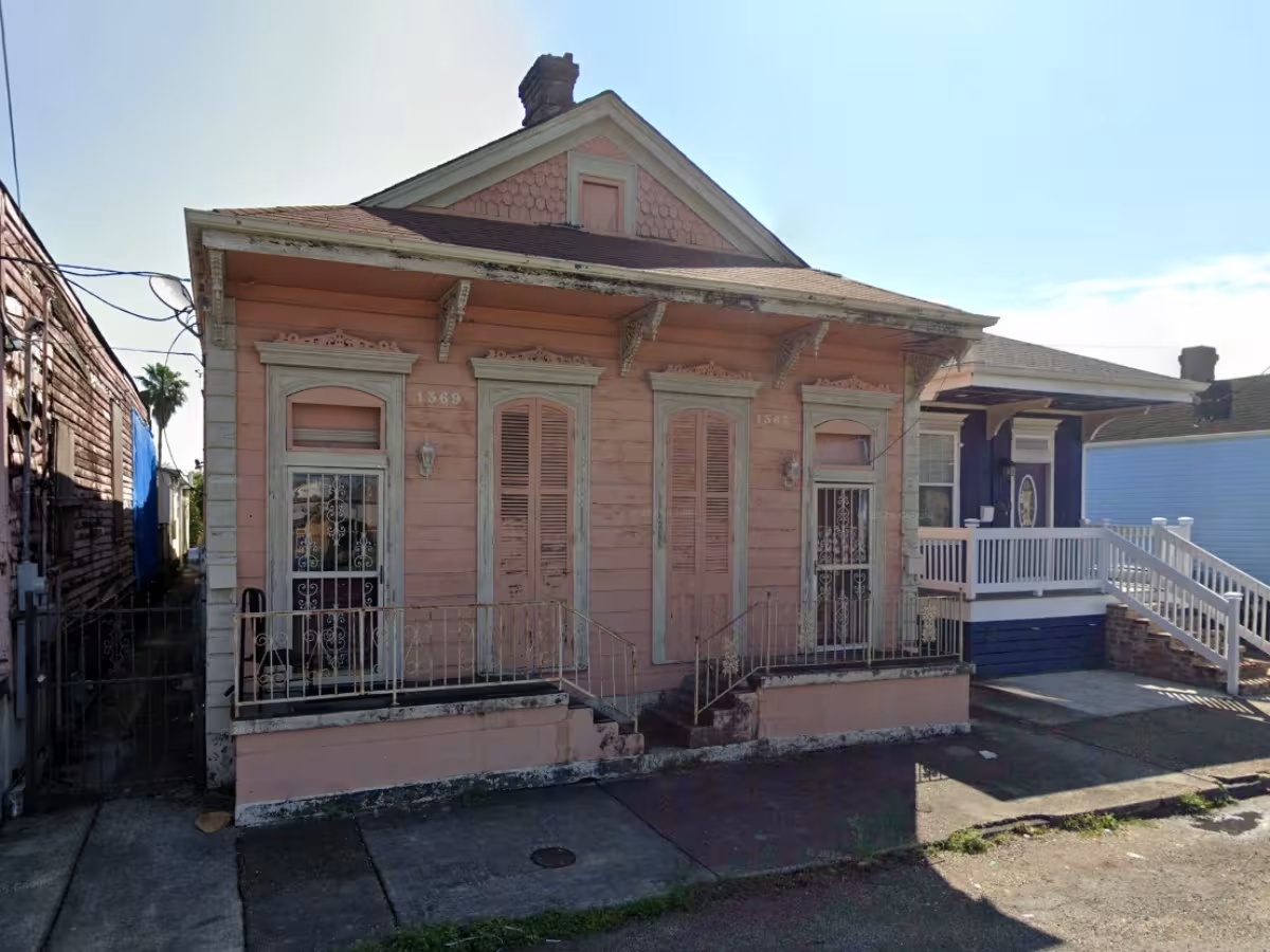
New Orleans, Louisiana. 1367–1369 Annette St. Photo: Google Maps.

Here are some of the best illustrations produced during a three-month journey in which I traveled through Belize, Guatemala, Mexico, and the United States in the winter of 1991–1992. I made these sketches outdoors, sitting on curbs, equipped only with a small notebook, a ruler, a graphite pencil, and a fine-tip Staedtler Lumocolor permanent marker.

Three decades later, I had the idea of locating these places in their current state using Google Street View. In some cases, the search proved challenging—worthy of a game of GeoGuessr—while in others it was relatively easy, thanks to precise memories.

Guatemala

  1. Antigua Guatemala. Former capital listed as a UNESCO World Heritage Site. Spanish colonial building now serving as an evangelical church. 2a Calle Oriente 14. 14.559633 -90.732249.
  2. Los Encuentros. An unattractive road junction but bustling with activity. From the capital, it allows one to switch from one bus to another to continue toward Chichicastenango, Quetzaltenango, or Lake Atitlán. Location: 14.854758 -91.148597.
  3. Sololá. Large town located on the heights above Lake Atitlán and on the road leading to the tourist village of Panajachel. The bell tower is located on the rather lively central square.
  4. Sololá. Illustration of the Ordóñez Pharmacy made while I was surrounded by a whole group of curious children. Location: 14.770743 -91.182678.

Mexico

  1. Guanajuato. Palacio de los Poderes Museum and Conde Rul Museum. House built in 1802, in neoclassical style. Partial rendering due to lack of horizontal space on my page. Av. Benito Juárez 75. 21.003572 -101.244034.
  2. Guanajuato. Casa de la Presa, an Art Nouveau house built in 1910, now housing a café, shops, and offices. P.º de La Presa 21.00338 -101.24408.
  3. La Paz, Baja California Sur. Variegated commercial building that has undergone major transformations over time. Identified thanks to the liquor store still in operation, and thanks to the checkerboard ceramic tiles on either side of the door leading upstairs. 16 de Septiembre 285. 24.159646 -110.314356.

United States

  1. Oakland, California. House where I stayed for a week. House where I stayed for a week. A “multiplex” located opposite a punk commune, at the junction between the upscale university district of Berkeley and the rough inner-city neighborhoods of Oakland. 5709 Genoa St. 37.84233 -122.27255.
  2. Oakland, California. 1965 Chevrolet Impala parked on Genoa St.
  3. San Francisco, California. House impossible to locate, probably located in the Haight-Ashbury neighborhood or a nearby neighborhood.
  4. Santa Fe, New Mexico. Building located opposite the Cathedral, in the historic center of the city. 132 E Palace Ave. 35.687339 -105.936634.
  5. New Orleans, Louisiana. Wooden house on brick piers, quite difficult to locate. Two possibilities: 1229 Frenchmen St. 29.970277 -90.0581107. Clues: shape of the neighboring house, decorative fixtures consistent with the illustration, position of the electrical supply. Otherwise, it could be 1369 Annette St. Clues: manhole on the sidewalk, no. 136 on the shed, color matching my memory. Incidentally, walking through Faubourg Marigny to admire these pretty houses allowed me to observe to what extent racial segregation was still very present in the southern United States. This foray into the neighborhood earned me being “expelled” from it by a rather well-built Black man who was not in the mood to laugh! A certain gentrification can be observed in recent Street View photos, but the neighborhood quickly takes on a rundown appearance a few hundred meters further north.