
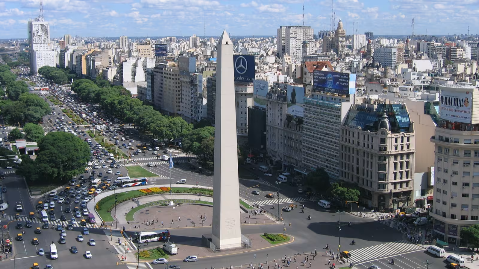




Many of the world’s great cities feature an obelisk, and the capital of Argentina is no exception. Erected in 1936 on Plaza de la República, on the very site where the flag of the Argentine Republic was first raised, the Buenos Aires Obelisk is striking for its sheer scale. Yet something seems amiss with this country, which has drifted from military defeat to economic crisis for several decades, despite its great cultural wealth and abundant natural resources.
A Window into the Economic Fragility of an Entire Continent
Plagued by persistent problems of governance, Argentina also suffers from its geographical isolation. It would be far less vulnerable if it were able to trade more naturally overland with neighboring countries and the rest of the world.
The vast Argentine railway network, developed as early as 1855 with French and British capital, converges on the ciudad porteña in order to facilitate the maritime export of agricultural goods to Europe. In this light, it appears that the location of the Buenos Aires Obelisk was not chosen at random. From a symbolic standpoint, the monument emerges as the “lock” keeping Argentina, and indeed all of South America, under the tutelage of the Empire¹.
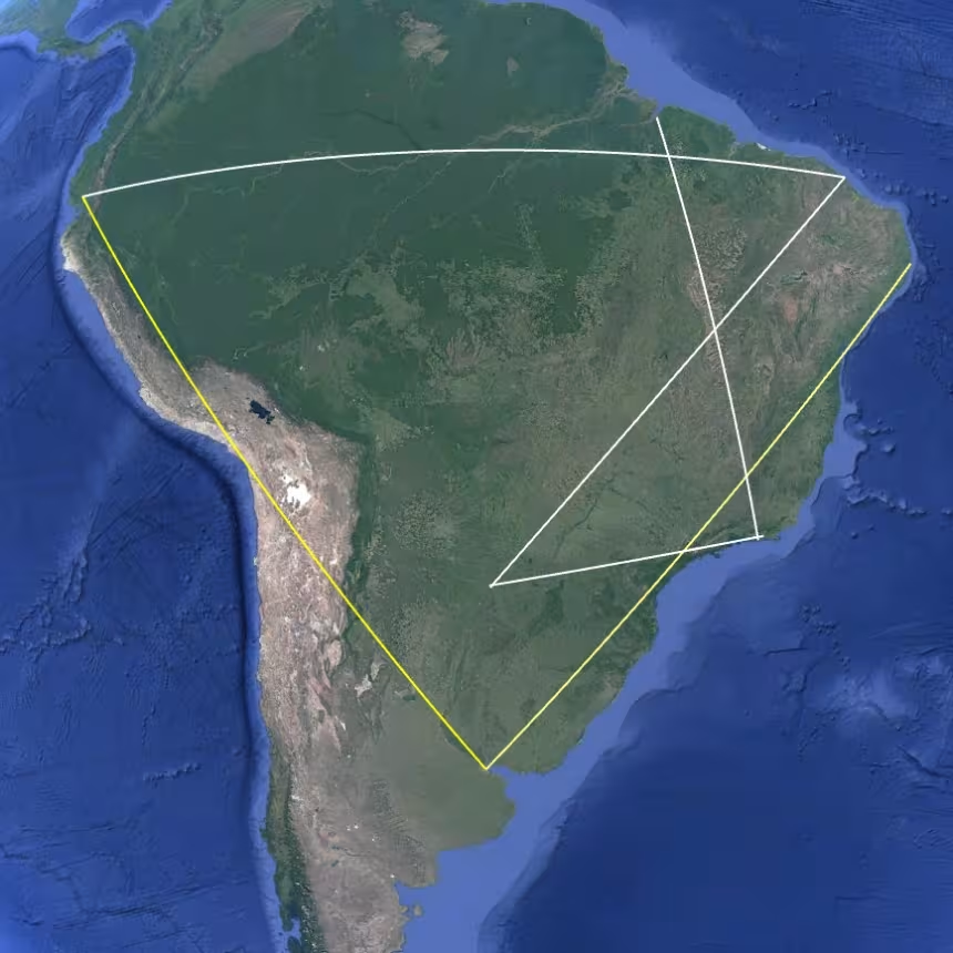
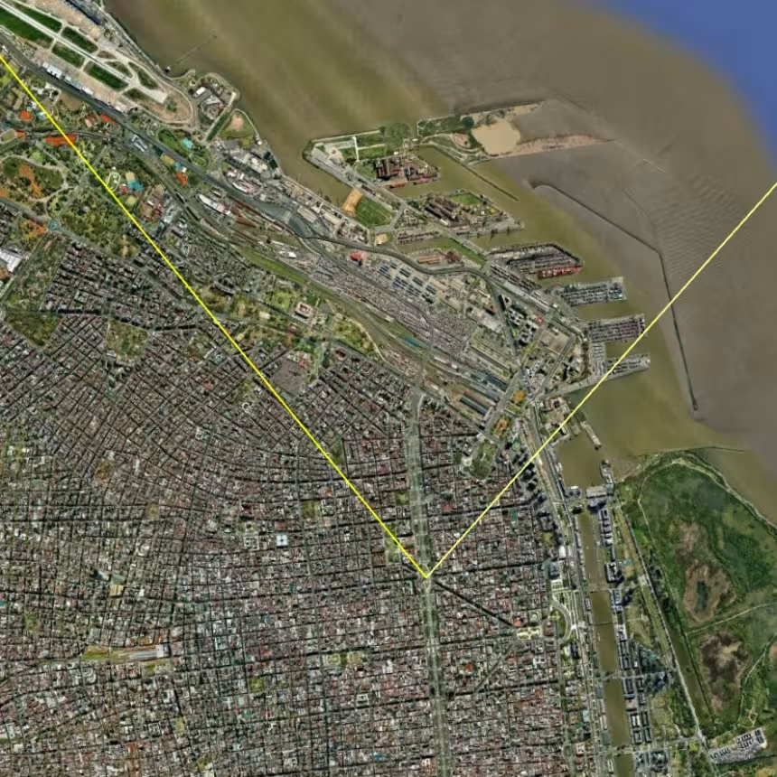
By extension, we will see how the Buenos Aires Obelisk casts its shadow over the continent’s main ports, airports, and road networks, making Argentina a model of (under-)development and the Achilles’ heel of several other economically fragile countries. From Plaza de la República, it is enough to draw two vectors, whose full symbolic precision is revealed to us through Google Earth.
Visualization in Google Earth
You are invited to download the attached .kmz file below in order to better visualize the alignments and points of interest it contains. (For best results, first disable the generic borders and places provided by Google Earth, then enable the placemarks included in the file.)
 BuenosAires.kmz
The Buenos Aires–Recife Axis
Unlike the patchwork countries along the Pacific and Caribbean coasts, Brazil is the only country in South America with a substantial domestic market. Yet this colossus with feet of clay lacks a railway network worthy of the name, and we will see how its major ports, airports, and highway interchanges line up along a handful of axes to produce an interface of striking linearity.
After crossing the port area of Buenos Aires, the vector drawn toward Brazil splits the Belo Horizonte metropolitan area into two equal halves and clearly overflies Pampulha Airport. Note that Belo Horizonte ranks third among Brazil’s most populous metropolitan regions, with 5.9 million inhabitants.
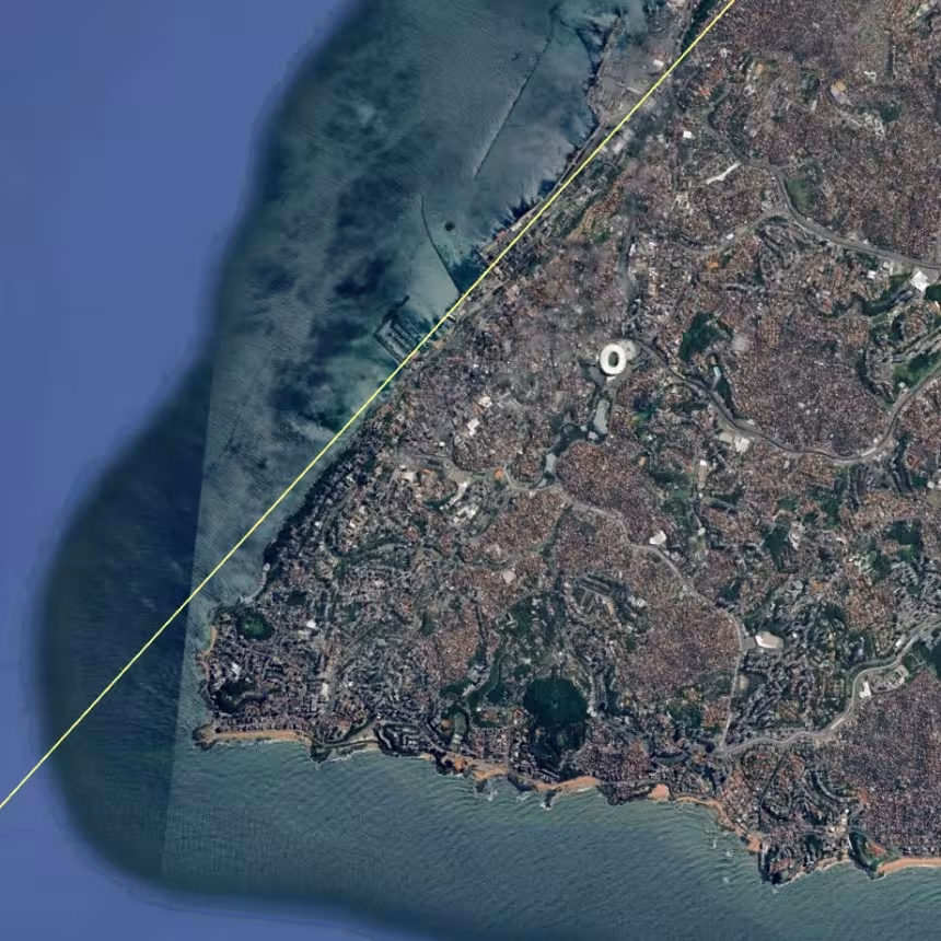
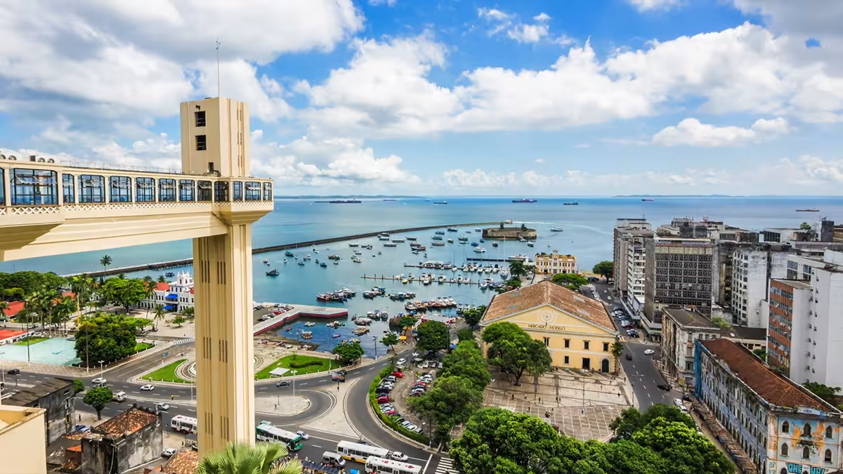
In Salvador, this alignment runs along the old port with astonishing precision. Mercado Modelo, the Elevador Lacerda, and the Igreja do Bonfim, iconic landmarks of Brazil’s former capital, naturally point the way toward the Nordeste. In Recife, the vector once again follows the geographic orientation of the port area, ending its course at the Carmelite church of Olinda, a colonial city founded in 1535.
The Buenos Aires–Arica–Guayaquil Axis
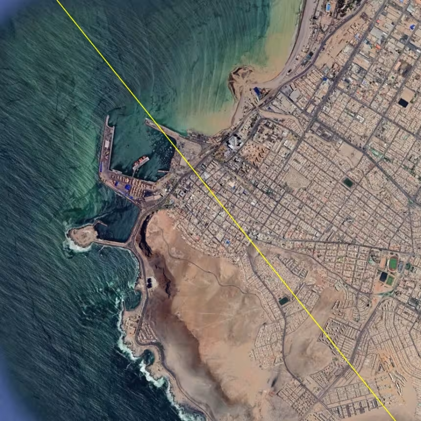
Founded in 1541, the city of Arica was long contested by Peru, Bolivia, and Chile. It is well known that Chile derives a large share of its revenue from the mining industry, but Arica’s heyday dates back to the period when it served as an export port for silver ore from Potosí, in Bolivia. The founding of Buenos Aires on the Río de la Plata (literally, the River of Silver) in 1536 only reinforces the symbolic power of this axis. Indeed, the creation of the Viceroyalty of the Río de la Plata in 1776 made it possible to export part of this silver through Buenos Aires.
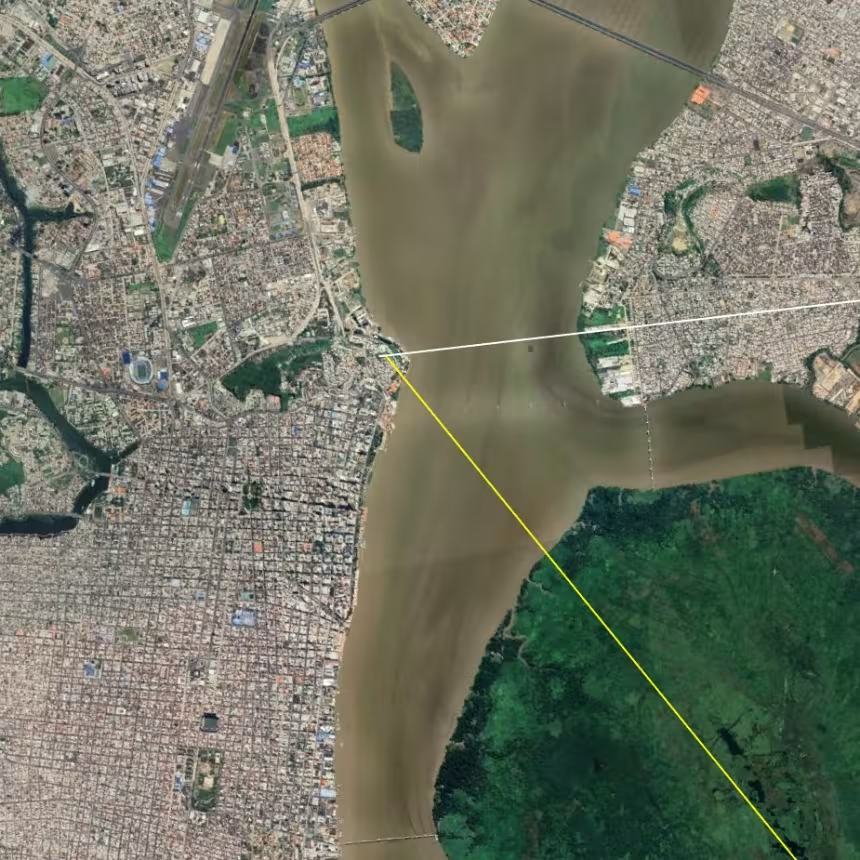
Following the logic established above, it seemed natural to draw a line between the Obelisk of Buenos Aires and the port of Arica. To my complete astonishment, the extension of this line leads directly to Cerro Santa Ana, the founding site of Guayaquil, the economic capital of Ecuador.
The Guayaquil–Manaus–Fortaleza Axis: the Base of the Pyramid
On a continent as densely populated and highly structured as Europe, it is hardly surprising that cities and their monuments produce more or less striking alignments. By contrast, it is far more remarkable that the city of Manaus, isolated in the heart of the Amazon rainforest, should lie approximately halfway between Guayaquil and Fortaleza.
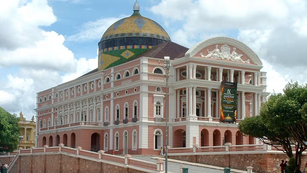
For the purposes of this article, I drew the line so that it passes over the Amazon Theatre. This emblematic monument of the “Paris of the Tropics” was built during the Rubber Boom, which brought great wealth to the city between 1879 and 1912. From a more strategic standpoint, this axis also crosses the Rio Negro Bridge and the major inland port of Ceasa, that is, the two key crossings linking Manaus to the southern bank of the Amazon River and to Highway BR-319 leading toward the soybean-producing regions.
The Strategic Position of Asunción
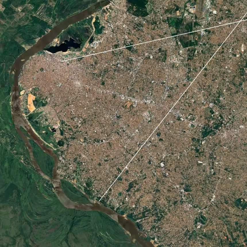
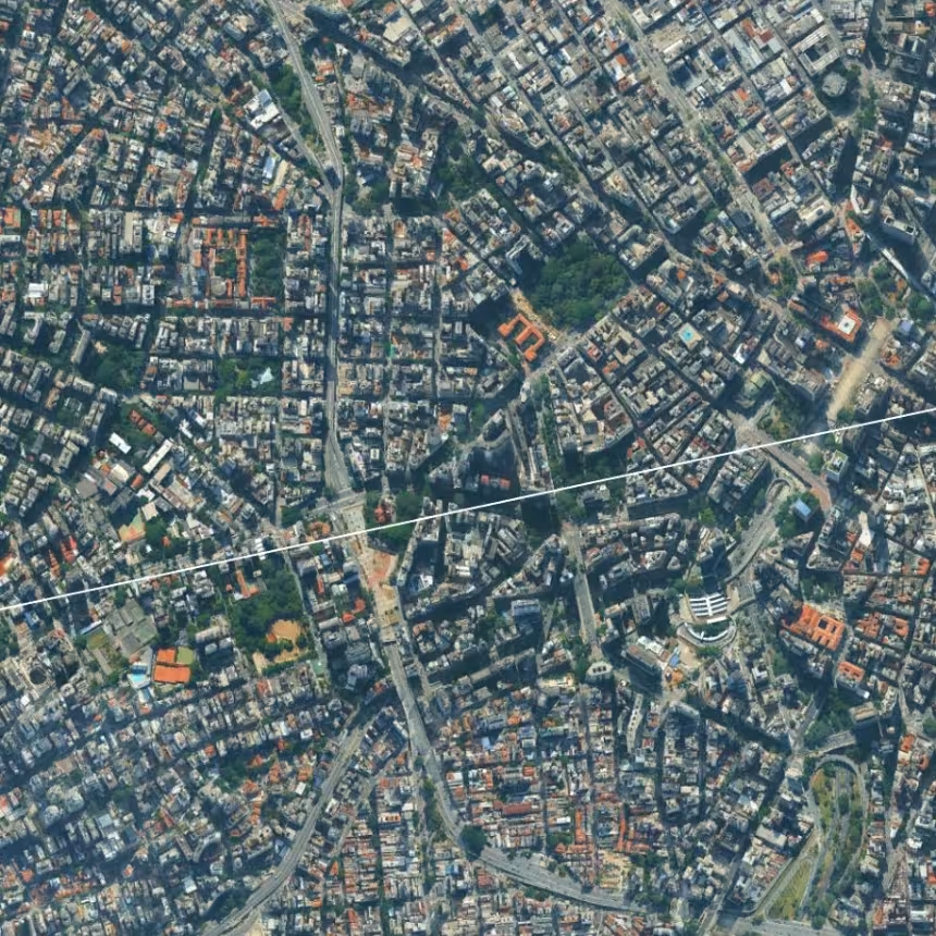
The three axes described so far form a kind of inverted pyramid, whose apex would be the Obelisk of Buenos Aires. It now becomes easier to see how the other cities of the continent are articulated within this structure. The city of Asunción, the little-known capital of Paraguay, appears to play a particular role. The National Pantheon is an ideal point from which to draw a vector toward São Paulo and Rio de Janeiro. To give this vector maximum symbolic weight, I routed it through São Paulo’s financial district as well as the Vale do Anhangabaú, a large public square adjacent to City Hall, beneath which runs a ten-lane expressway.
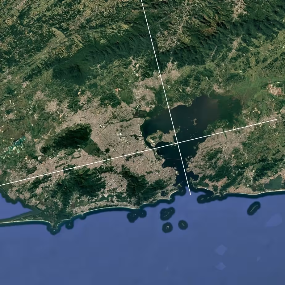
Extending this axis, we traverse the metropolitan region of Rio de Janeiro from west to east, over a distance of roughly one hundred kilometers. Among the points directly intersected are the port area, the highway viaducts leading to Galeão International Airport, and the Ilha d’Água oil terminal, all of which constitute absolutely vital infrastructure for the Brazilian economy.
From Asunción, one can also draw a continental axis crossing the city centers of Goiânia (2.4 million inhabitants) and Anápolis (386,000 inhabitants), touching the northwestern edge of the Federal District of Brasília (3 million inhabitants), and then reaching Fortaleza International Airport (4 million inhabitants). The axis ends at the Port of Mucuripe, known for its major oil refinery. This site is said to be one of the first landing points of Europeans in South America in 1500.
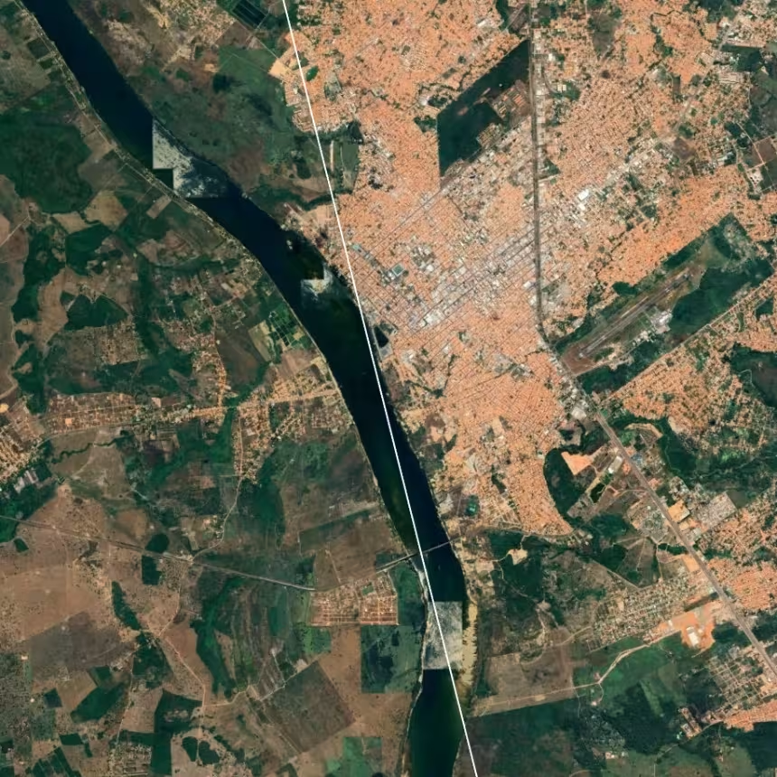
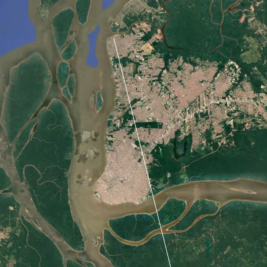
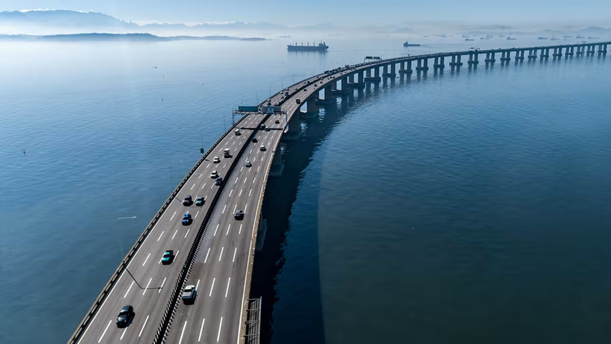
Finally, this scheme reveals a perfect alignment between the Rio–Niterói Bridge over Guanabara Bay, Raul Soares Square in Belo Horizonte, and the port of Belém at the mouth of the Tocantins River. This alignment also runs along the city of Imperatriz, on the Tocantins axis, where it intersects the Dom Affonso Felippe Gregory Bridge, which provides a crucial road link between the Northeast, the Central Plateau, and the Amazon region.
Conclusion
The major cities of the South American continent follow an extremely precise geometry. The five vectors traced here pass through no fewer than fifteen major cities, seven international airports, eight port areas, and five highly strategic bridges or viaducts. The Obelisk of Buenos Aires emerges as the apex of an inverted pyramid that keeps all of these sites firmly under watch.
Lima, Caracas, Santiago, and a few secondary cities such as Mendoza currently fall outside this scheme. Further research will be required to determine how these urban centers relate to one another and to the overall structure described here.
1 For the purposes of this article, the issue is not so much the British Empire — already in decline by the time the United Kingdom won the Falklands War in 1982 — but rather the system of globalized finance that succeeded it, grounded in maritime law, private international law, dollarization, and Wall Street hedge funds.